ThinkGeo Maps Streets Dataset
ThinkGeo Maps Streets is available in either PMTiles or MBTiles format. Both versions include a style.json file for styling and rendering the vector data.
- The vector tile database is provided as a single file approximately 75 GB in size.
- The tiles are simplified and optimized for efficient map rendering, with attribute data embedded in each tile. Because the dataset is designed for visualization, it cannot be used for routing or other purposes that require a routable street network.
- The dataset is available only in the Spherical Mercator projection (EPSG:3857), but can be easily reprojected as needed on the client side.
- PMTiles is the recommended format for ThinkGeo v15.0 and later. Earlier versions of ThinkGeo can use the MBTiles format.
Note: For complete usage instructions and programming examples, see the Vector Tiles Support page.
Data Source
ThinkGeo Maps Streets data is sourced from OpenStreetMap and Natural Earth, both of which are open data sets. The data is updated monthly on ThinkGeo servers. Generally speaking, Natural Earth is used at lower zoom levels, and OpenStreetMap is used at higher zoom levels.
-
OpenStreetMap
Open Street Map is built by a community of mappers that contribute and maintain data pertaining to roads, trails, cafés, railway stations, and much more, all over the world. OpenStreetMap's community is diverse, passionate, and growing every day. It's open data so you are free to use it for any purpose as long as you credit OpenStreetMap and its contributors.
-
Natural Earth
Natural Earth is a public domain map dataset available at 1:10 million (1 cm = 100 km), 1:50 million, and 1:110 million map scales. Featuring closely integrated vector and raster data, with Natural Earth one can make a variety of maps with all commonly used cartography and GIS software. Natural Earth is designed to meet the needs of experienced cartographers using a variety of software applications. Natural Earth was built through a collaboration of many volunteers and is supported by the North American Cartographic Information Society(NACIS). It is free for public use in any type of project.
Use of ThinkGeo Maps Streets Data with ThinkGeo UI Controls
- Full details on usage and programming examples can be found on our Vector Tiles Support Page.
- You can also check out the latest HowDoI samples to see examples of PMTiles and MBTiles being used.
Sample Screenshots
The ThinkGeo Cloud Maps Vector Tiles service consumes the same MBTiles dataset that we've discussed in this article. Check out the Online Samples to learn more.
Here are some sample screenshots of the Maps Street dataset in action:
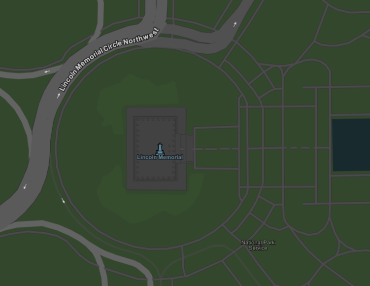
Lincoln Memorial in Washington DC:
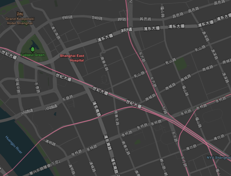
Downtown Shanghai: